UTAH COUNTY REGIONAL GRID STUDY
Study Overview
What is a Regional Grid System?
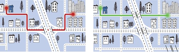
A system of regional roads that help connect people to and from destinations. A well-connected grid system allows for better connections for cars, bicyclists, pedestrians, and transit vehicles that reduces travel time and helps spread travelers out, reducing congestion.
A grid system consists of:
Definition:
Roadways that focus on regional mobility, fewer stops and higher speeds.
Examples in Utah County:
- Timpanogos Highway (S.R. 92)
- S.R. 189 in Provo Canyon
- State Street, Spanish Fork to Lehi
Definition:
Roadways that collect travelers from neighborhoods and help them access arterials.
Examples in Utah County:
- 400 East in Orem
- 500 North in Provo
- Arrowhead Trail Road in Spanish Fork
Roadways serve two main purposes, to provide mobility and to provide access.
- A regional grid is a roadway network that provides multiple routes (access) to destinations for commuters and other travelers.
- The more connections created, the faster and further people can get to their place of work, school, or to commercial districts (mobility).
Utah County History - How did we get here?
Utah County originally developed as small farming communities; the historic city centers laid out in a gridded network. Over time these communities grew organically, unifying urban and suburban areas without clear borders and without necessary regional connections to facilitate travel between cities. Because this growth happened slowly, regional transportation systems were not preemptively planned, and the network was not implemented on a regional scale or in a way that anticipated growth.
MAG has developed a thorough long-range plan that will guide the future of the network in Utah County. As part of that plan, MAG conducted a preliminary study for an 'ideal' gridded network for Utah County.